




Class Project • Applied Learning
From Drone Photographs to a 3D Site Model
Created by Andrea Davis-Baptiste during drone coursework, this project illustrates how drone photographs can be processed into a three-dimensional view of a site. Explore the model image and accompanying video.
- Drone photographsOverlapping aerial images of the site
- PhotogrammetryProcessed in PIX4Dmapper
- 3D site modelModel image and fly-through video
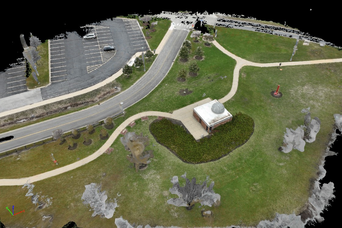 Select to enlarge
Reading the modelWhat the image and video show
Photogrammetry software matched features across overlapping drone photographs and rebuilt the site in three dimensions. Areas that appear grey, patchy or black, such as some trees and the model edges, had less photo coverage. They are shown exactly as the software produced them; nothing has been filled in or regenerated.
This is an educational class project, not a client deliverable or a survey-grade product.
Coursework for DRO 102 at Harper College · Processed in PIX4Dmapper